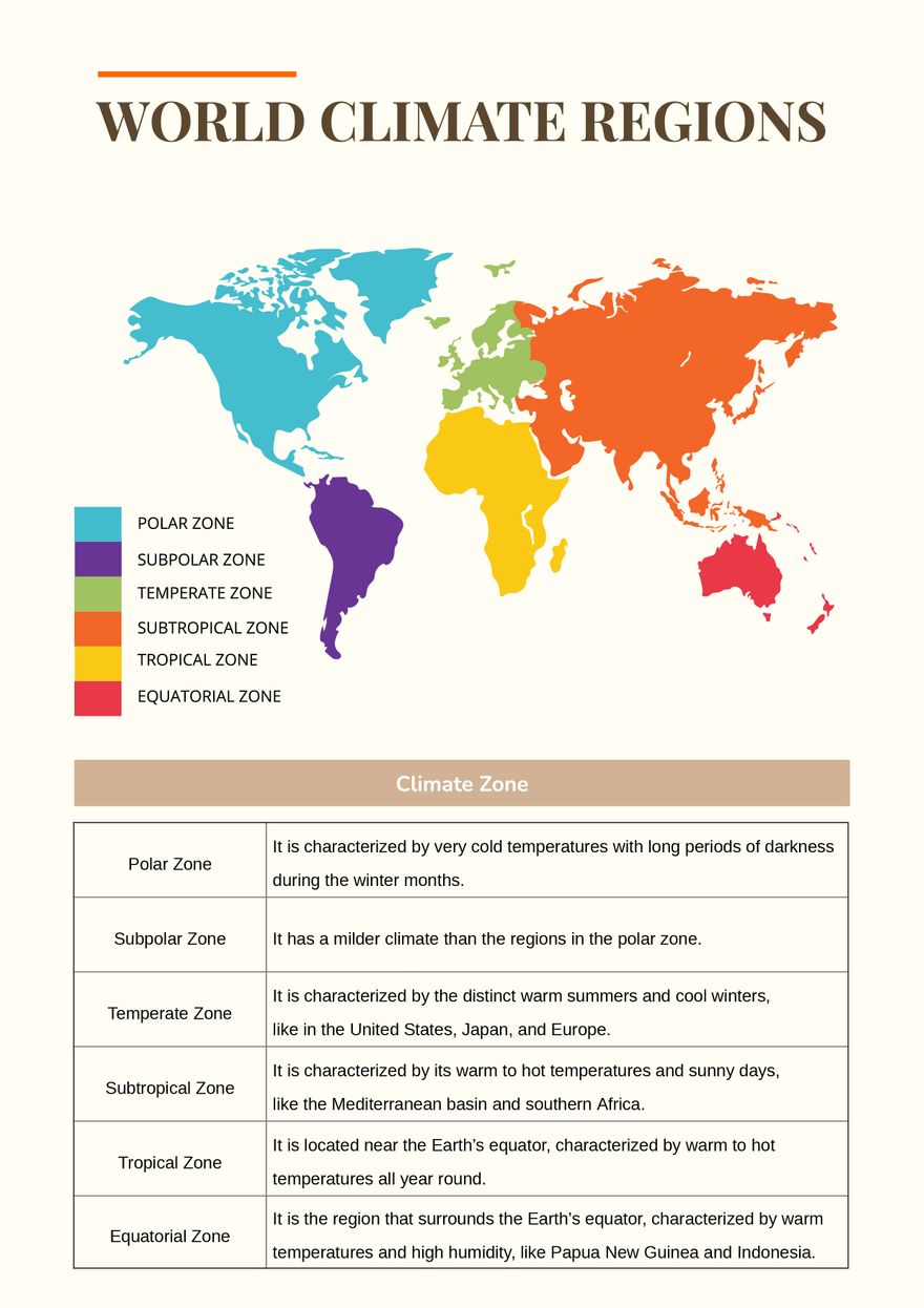
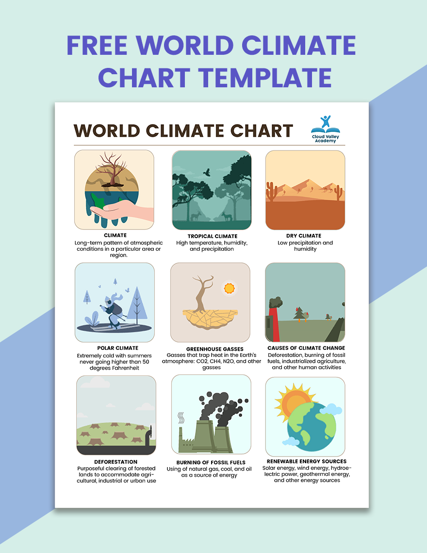
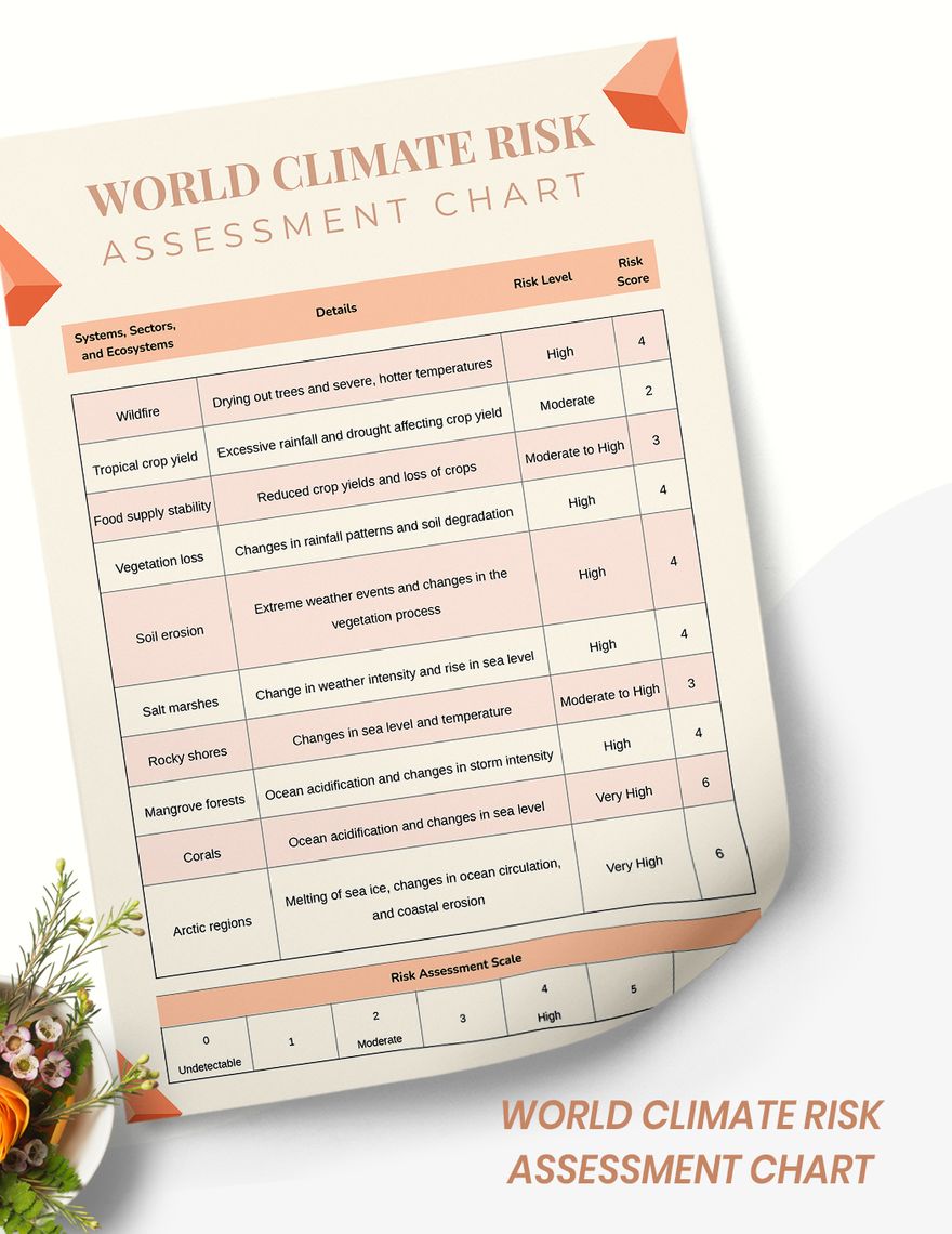
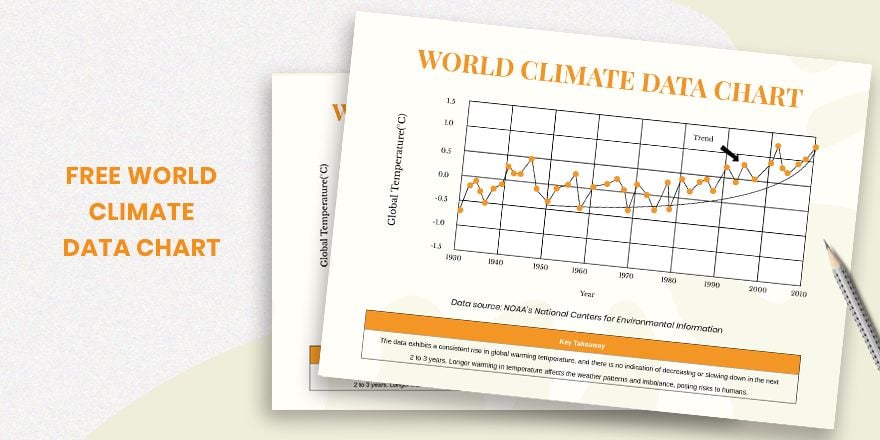
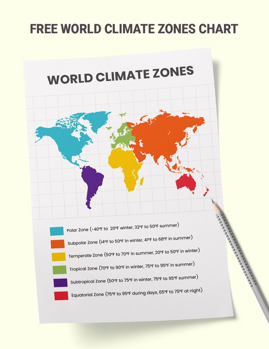
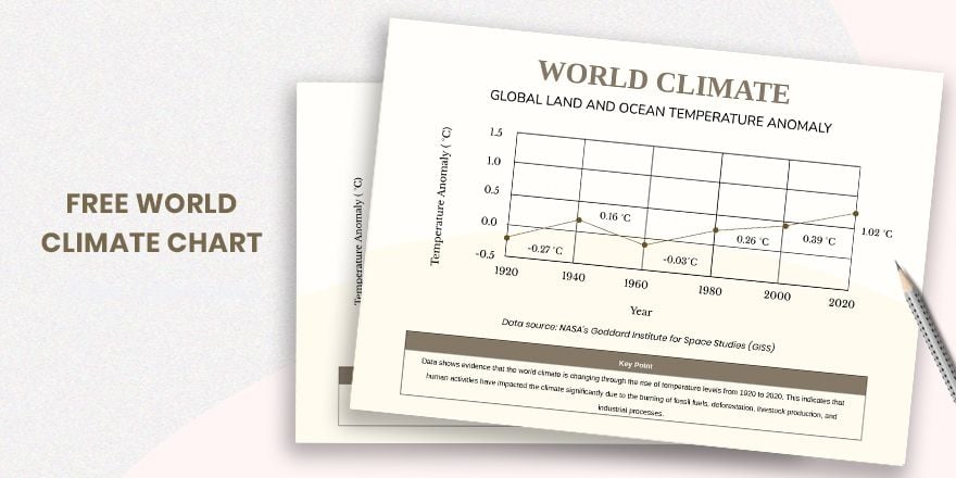
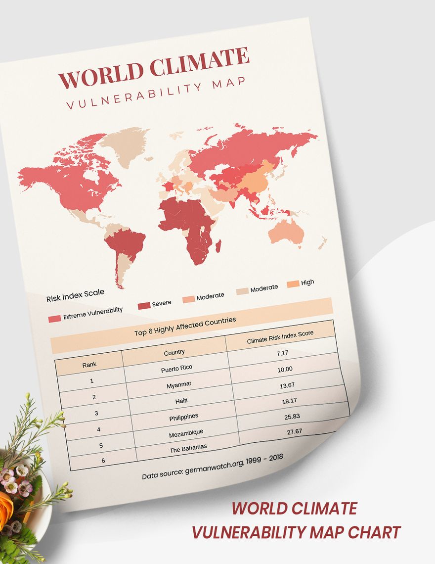
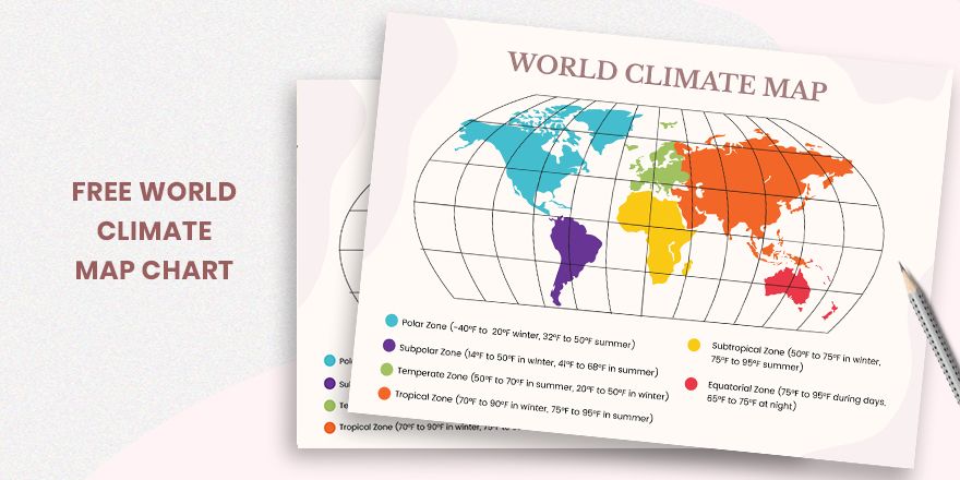
World Climate Regions Chart
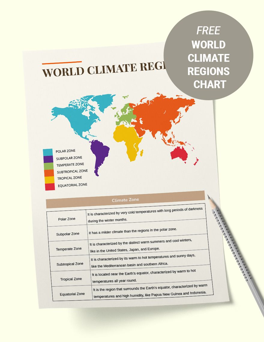
Download this World Climate Regions Chart Design in Illustrator, PDF Format. Easily Editable, Printable, Downloadable.
Let students get a better understanding of the effects of global warming through a map. Download this World Climate Regions Chart that contains well-designed artwork and original content that is effective for visualizing information. It is a high-quality, printable material that supports teachers and educators. Get this now!
-
PDF
-
Illustrator
Already a premium member? Sign in
